Feature Projects:
Havelock North Dam breach study
A hydraulic model of each of the 5 flood detention dams above Havelock North was built for Hastings District Council. Each model included accurate topography for the reservoir valley, dam crest and spillway and underflow culvert. Using scaled increments of the Probable Maximum Flood as inflow hydrographs for each reservoir, breach was simulated when the dam was overtopped. Special hydraulic modelling software was used to generate the flood wave out of the dam as the breach developed. The ensuing flood hydrograph then flowed through a hydraulic model of the stream channel and overland flow paths downstream. Maximum flood depths along the streams were mapped and critical points where roads or properties flooded were identified.
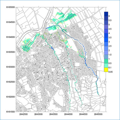
Example of flood map showing flood depths along the Te Kahika, School and Karituwhenua streams, Havelock North.
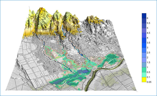
Example of 3 dimensional floodmap showing flood depths during 6hr PMF, Havelock North.